1550’s
Meherrin Nation is shown on an early Spanish map of Eastern North America
1584 -1650
Meherrin were referred to (collectively with other Iroquois-Tuscarora and Nottoway) as Mangoag and Mangoak. The Mohawks, Oneida, Onondaga, Cayuga and Seneca (Iroquois Confederacy) were also referred to as Mangoak and Mingoes, by their coastal Algonquin neighbors from Carolina to Canada.
“The Mangoags also known as the Mangoaks, were an Iroquoian- speaking community, probably Meherrin and perhaps Nottoway with powerful trading connections….” (Michael Leroy Oberg, The Head in Edward Nugent’s Hand: Roanoke’s Forgotten Indians. Philadelphia, Penn. 2007).
The term “Mangoak” translates to “rattlesnakes,” “adders,” “real snakes,” “treacherous,” or “stealthy” depending on the source. (Quinn, David B. “Set fair for Roanoke: voyages and colonies, 1584-1606” North Carolina, America’s Four Hundredth Anniversary Committee). In other words it means “enemy.”
1586
English colonist, Ralph Lane wrote “Very neere [to the mouth of Chowan River] … directly from the West runneth a most notable River, and in all those parts most famous, called the River of Moratoc [Roanoke]. This River openeth into the broad Sound of Weapomeiok [Albemarle] . . . Moratoc it selfe . . . is a principall Towne upon that River . . . The Mangoaks . . . is another kinde of Savages dwelling more to the westward of said River” “Mangoak” was a term for Meherrin (and other Iroquois collectively)
(Quinn, David B. “Set fair for Roanoke: voyages and colonies, 1584-1606” North Carolina, America’s Four Hundredth Anniversary Committee)
Ralph Lane described how the Meherrins traded “wassador,” a “pale metal” which was referred to by colonials as copper. This was very valuable and sought after by all Natives along the east coast. Although there is debate over whether the copper was collected from local rivers, or traded from other regions, it was definitely refined and fashioned by Meherrin and others in the region. Copper was melted down several times and collected in “great fires” until a pure form of ore was collected and hammered. It was then sent to artisans who fashioned it into plates. It was said that the Mangoaks (Iroquois) decorated their longhouses with “fine parts” and “great plates” of wassador.
(Lane, Ralph. “The Colony At Roanoke.” 1586)
1586
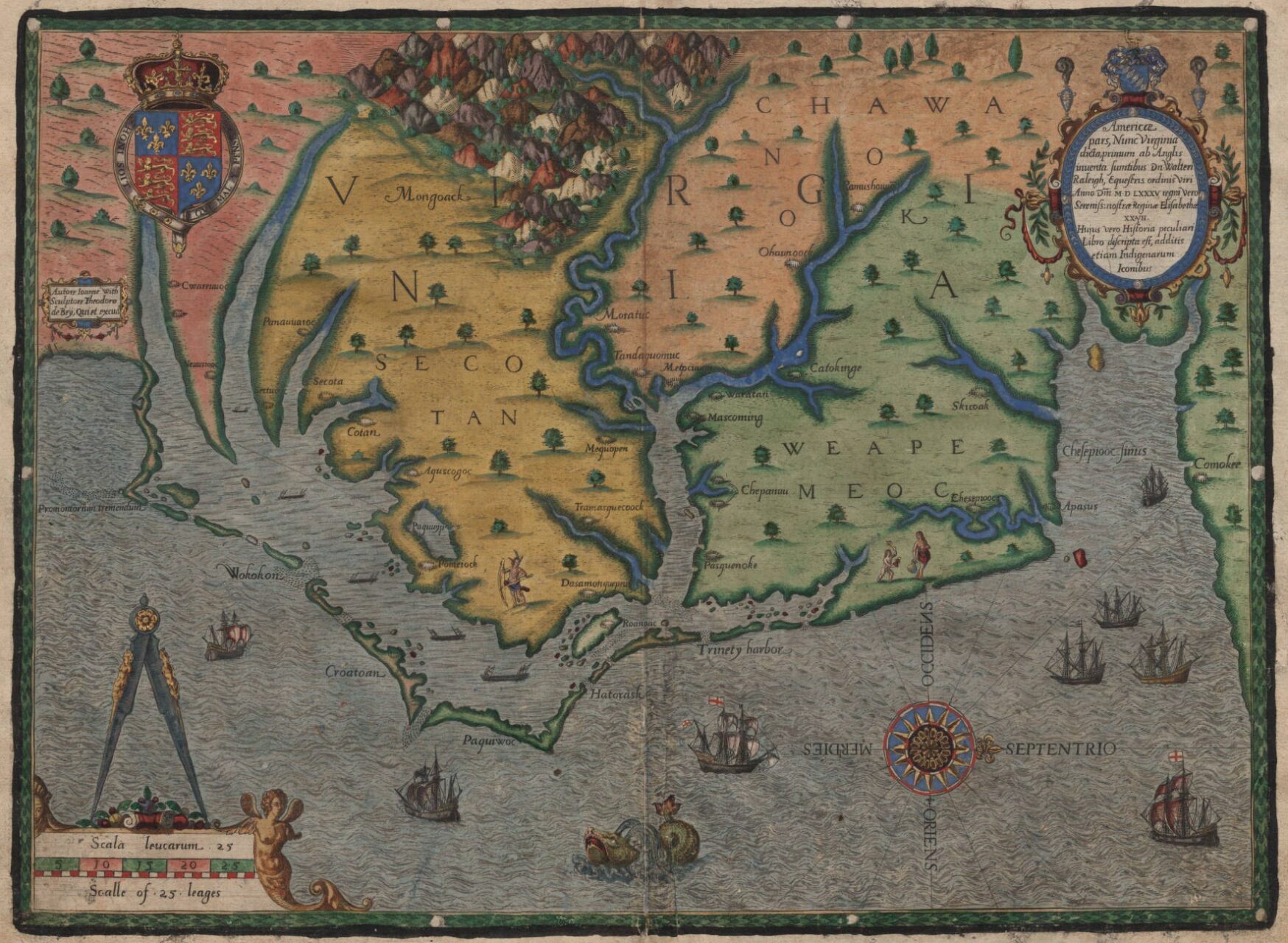
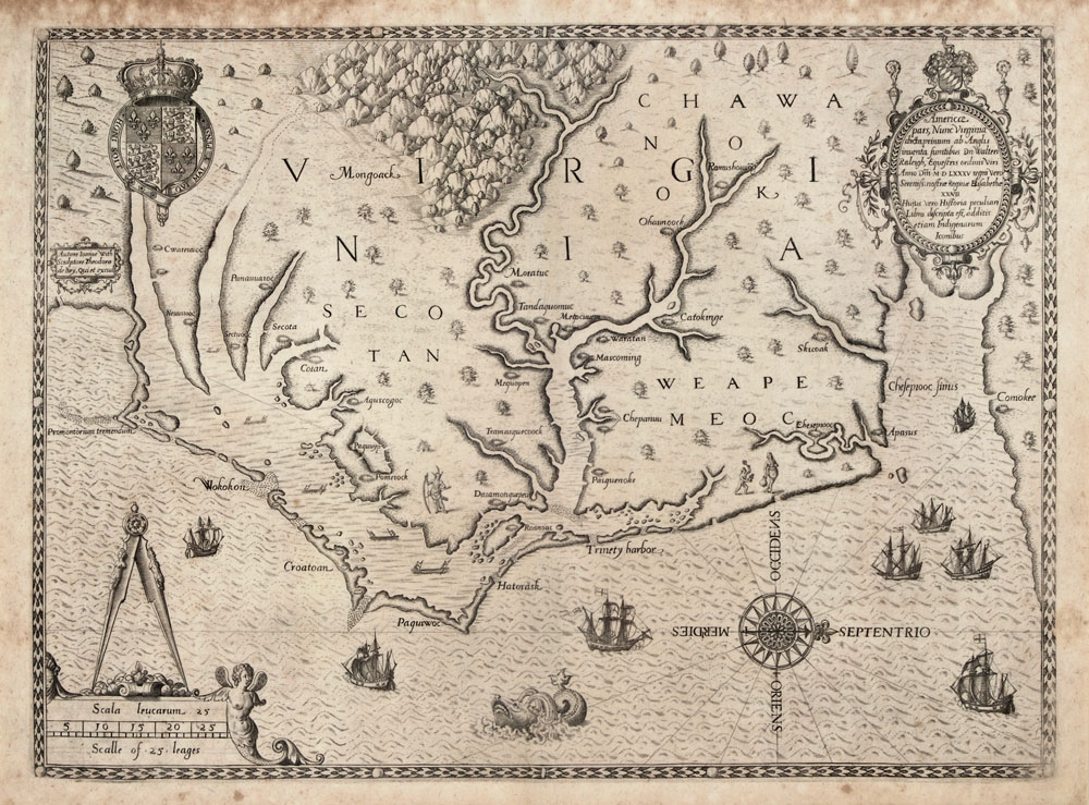
Map of the coast of Virginia and North Carolina, drawn 1585–1586 by Theodor de Bry, based on map by John White of the Roanoke Colony.
1590
Meherrins are identified on an early map as “Mangoack” in 1590. This map, by John White, was the first to use the name Chesepeak “Chesepiooc Sinus.” John White was the artist who painted the early watercolors of Coastal Algonquin People, their towns, ceremonies, farming and fishing. White was deeply involved with the Lost Colony.
1590
Map of the coast of Virginia and North Carolina, by Theodor de Bry, based on map by John White of the Roanoke Colony. Printed in 1590
Hand-colored view of the coast of North Carolina at the time of the first attempt at a British settlement in North America, 1585. The map shows the Outer Banks and coast of North Carolina from the modern Virginia border south to Cape Fear. The Native American villages of Secotan and Weapemeoc are depicted, as well as many others. There are many hand-drawn illustrations, including ships, sea monsters, Native Americans, and mountains. North is oriented to the right.