Weecacana Trading Path
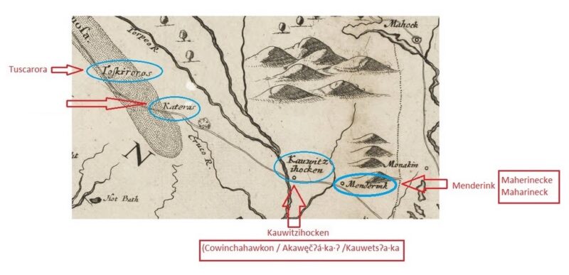
The Weecacana Trading Path also known as the Tuscarora Trading Path connected the Skarù·ręʔ (Tuscarora) to the Kauwetsʔa·ka (Meherrin) town of Kauwitzihocken, which was close to the Roanoke River, and the Kauwetsʔa·ka (Meherrin) town of Maherinecke also known as Menderink and Maharineck, which was on the Meherrin River.
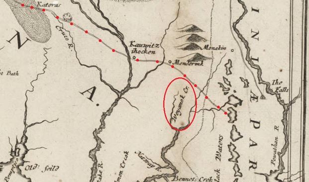
It’s Believed that the Weecacana Trading Path crossed the Roanoke River at Flotera Fort by Plumb Tree Island and Weldon, North Carolina.
The Weecacana Trading Path led north to the Weyanok (Wyanoke, Weyanoke) who were the go between in trade with the Iroquoian Tuscarora, Meherrin, and Nottoway and the Algonquian Powhatan.
Weyanoke also spelled Weyanock, as British colonist John Smith recorded on his map. Alternative spellings include Weanoc, Weanock, Winauh, Winauk, Wynauh, and Wynauk. Their name may mean “at the bend” of a river, coming from either the Eastern Niantic or Nipmuck language.
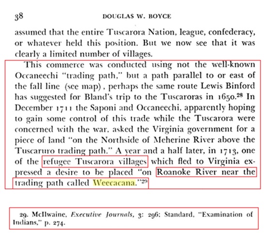
On December 19th, 1711, the Saponi who were enemies of the Tuscarora and Meherrin met with the Virginia Governor at which time they asked for permission to take up residence on the Northside of the Meherrin River above the Tuscarora trading path which would have been the previously inhabited Meherrin town of Maherinecke also known as Menderink and Maharineck. With direct access to the Trading Path it, was their intention to gain control of trade while the Tuscarora were concerned with war.
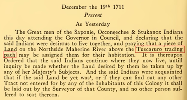
In 1713 Tuscarora refuges who fled to Virginia asked for permission to take up residence on the Roanoke River near the trading path of Weecacana, this may very well have been the previously inhabited Meherrin town of Kauwitzihocken.