Archaeology

Archaeological Evidence

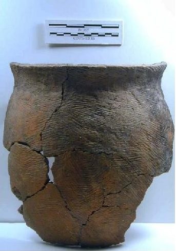
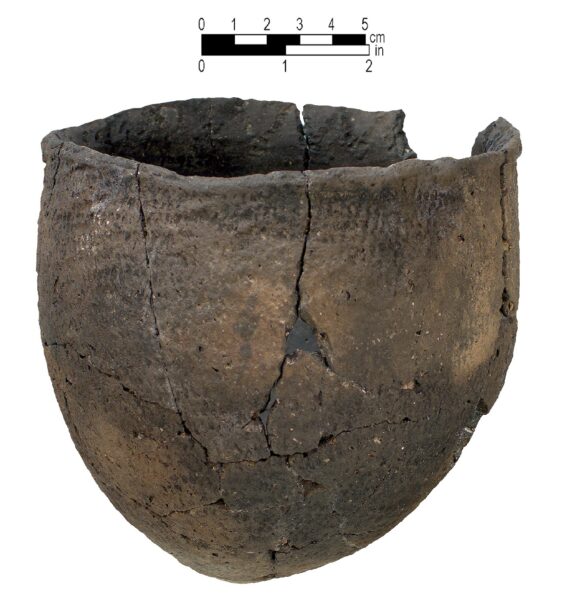
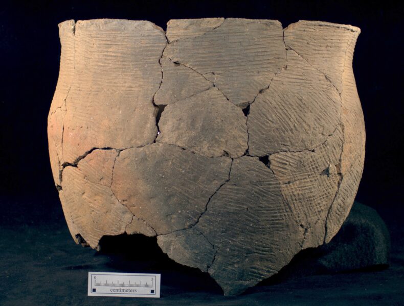
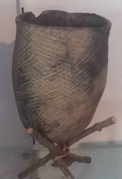
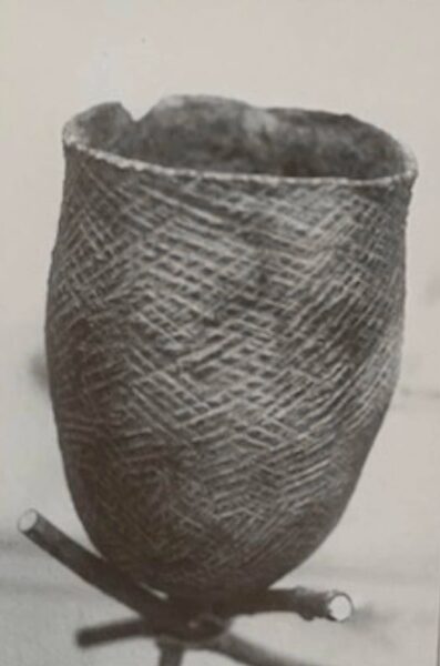
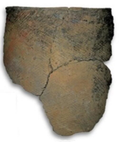
Archaeologists confirm that the ancestors of the Meherrin were living in the NC/ VA region. The pottery style shared by them and other NC Iroquois people is labeled as Cashie, and gives an umbrella name for their culture and way of life. (Mathis, Mark A. and Jeffrey J. Crow. The Prehistory of North Carolina: An Archaeological Symposium. N.C. Division of Archives & History, 2000).

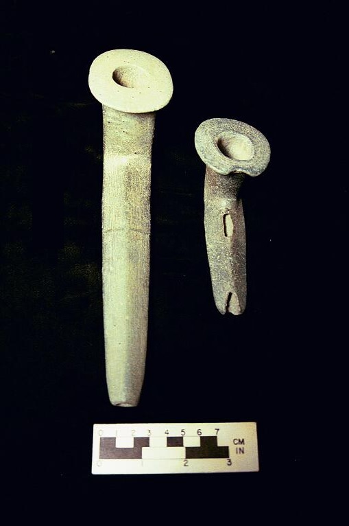
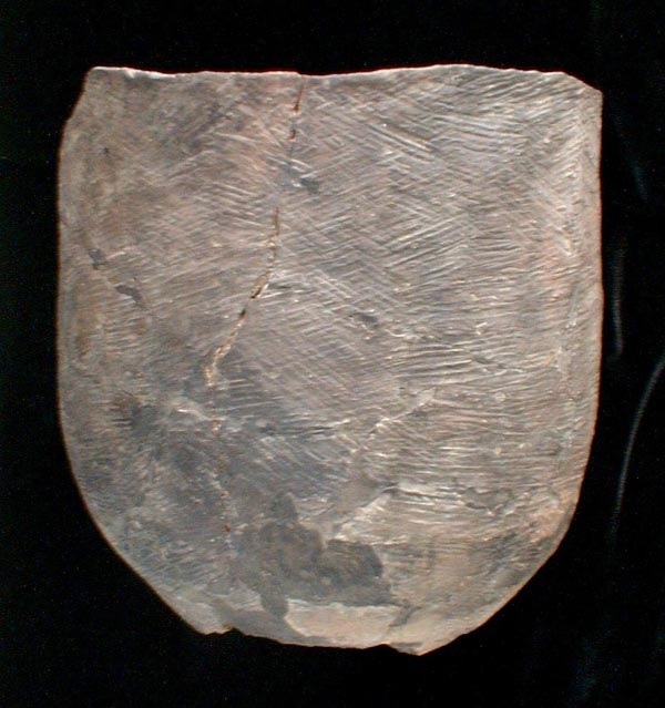
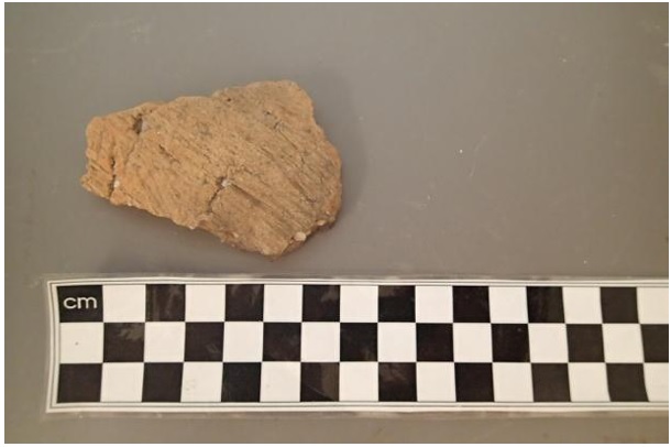
There is no archaeological distinction between Meherrin artifacts and those of the Tuscarora.

Archaeological evidence of the Meherrin Indians includes a variety of artifacts, such as pottery, tools, weapons, and personal ornaments. Excavations have been conducted at several Meherrin sites in Virginia and North Carolina, including the Meherrin River Site, the Stone’s Landing Site, and the Jarratt Site.

The Meherrin River Site is an archaeological site located along the Meherrin River in Hertford County, North Carolina. It is a prehistoric Native American site that was inhabited by the Meherrin people. The site was discovered in the 1930s and has been the subject of several archaeological studies.

The Meherrin River Site is believed to have been occupied from around 800 AD to the late 1600s, which coincides with the time period when the Meherrin people were living in the area. The site contains the remains of several prehistoric Native American villages, including evidence of houses, storage pits, refuse pits, and several burial mounds, indicating the importance of mortuary practices in Meherrin culture. Archaeologists have also uncovered a number of artifacts at the site, including pottery, stone tools, and bone tools.

One of the most notable finds at the Meherrin River Site is a series of large, circular earthen mounds that were used for ceremonial purposes. These mounds are believed to have been constructed by the Meherrin people and were used for a variety of purposes, including burials, ceremonies, and possibly even as platforms for houses. The largest of these mounds measures approximately 60 feet in diameter and 6 feet in height.

Overall, the Meherrin River Site provides important insights into the prehistoric Native American culture of the Meherrin people and their way of life along the Meherrin River. It is a significant archaeological site in North Carolina and is listed on the National Register of Historic Places.


The Stone’s Landing Site is located on the Roanoke River in North Carolina and was occupied by the Meherrin during the Late Woodland and Contact periods.

The site was first identified in the 1960s and has been the subject of several archaeological investigations since then.

Archaeological evidence suggests that the site was occupied by the Meherrin people from the Late Woodland period (ca. 1000 CE) through the Contact period (ca. 1500-1700 CE). Artifacts found at the site include stone tools, pottery, and evidence of shellfish gathering and fishing.

One of the most notable features of the site is a large shell midden, or pile of discarded shells, that was used by the Meherrin for hundreds of years. The midden is estimated to be about 40 feet high and covers an area of several acres.

In addition to the shell midden, archaeologists have identified the remains of several structures at the site, including a large circular structure that may have been a ceremonial or communal space. The site is also located near several important waterways, including the Roanoke River, which would have provided the Meherrin with easy access to transportation and resources.

The Stone’s Landing Site is an important archaeological site that provides valuable insights into the lives and culture of the Meherrin people.


The Jarratt Site is an archaeological site located in Greensville County, Virginia, along the Meherrin River. The site was first discovered in the 1950s and has been studied extensively by archaeologists, who have identified it as a major prehistoric settlement of the Meherrin people.

Excavations at the site have yielded evidence of Meherrin occupation, including a large rectangular structure that may have served as a communal dwelling or council house. Artifacts found at the site include pottery, stone tools, and shell ornaments, and other features that suggest a large and complex community. The site was occupied from around 800 AD to the early 17th century, and evidence suggests that it was a major center of trade and exchange, with artifacts found at the site coming from as far away as the Great Lakes region and the Gulf of Mexico.

In addition to its importance as a prehistoric settlement, the Jarratt site is also significant for its role in the history of colonial Virginia. In the early 17th century, the site was visited by the English explorer John Smith, who wrote about the “Meherrin Towne” in his accounts of his travels in the region. The site was also visited by the English colonists who established the nearby town of Hicksford (now Emporia) in the 18th century.

Today, the Jarratt site is protected by the Virginia Department of Historic Resources, and efforts are underway to preserve and interpret the site for the benefit of future generations.

Overall, archaeological evidence indicates that the Meherrin were a complex and sophisticated society with a rich material culture. Excavations at their sites continue to provide insights into their lifeways and traditions.

Cashi Pot


Colington Pot


Stone Pipes

Meherrin Pot


In 1705 the colonial government of Virginia defined the lands of the Meherrin as follows (Mcllwaine 1912a:98):

Resolved – the bounds of the Meherrin Indians land be laid out as followeth … a streight line shall be run up the middle of the neck between Meherrin river and the Nottoway river from the mouthes of ye said rivers so far as will include between that line and the Meherrin River so much land as will be equal in quantity to a circle three miles round their town.

Such a block of land is a formidable area within which to locate the settlement; however, the problem resolves itself somewhat, in that in all references to the settlement it is described as being at the mouth of the river . The actual mouth of the river is bounded on the north by inhabitable black gum swamp, and the only land close to the mouth on the north side of the river is about a half mile west of the actual river mouth. We may tentatively identify this land as the site of the Meherrin settlement

An attempt was made to locate this settlement archaeologically with some degree of success. On the edge of a fluvial terrace adjacent to the low swamps at the mouth of the Meherrin River, there is an extensive archaeological site designated the “Parker’s Ferry site’ and recorded in the files of the Laboratory of Archaeology at the University of North Carolina as site Hf 1 and Hfv2. This site yields materials assignable to a number different time periods recognizable in the archaeological sequence in the region; however, the most extensive occupation was in the historic period and the remains are assignable to the Meherrin with fair certainty. Trade items of European manufacture were relatively frequent, including kaolin pipe fragments and glass bottles as well as gun flints. For a description of these materials see Binford (1964:269-70, 402-7).